Heavy Thunderstorms Cause Local Flooding, More On The Way
Western New York was treated to an unbelievable lightning show last evening that moved in from across Lake Ontario between 10 pm and midnight. Along with thunder and lightning came heavy rain and gusty winds, causing flooding in poor drainage areas.

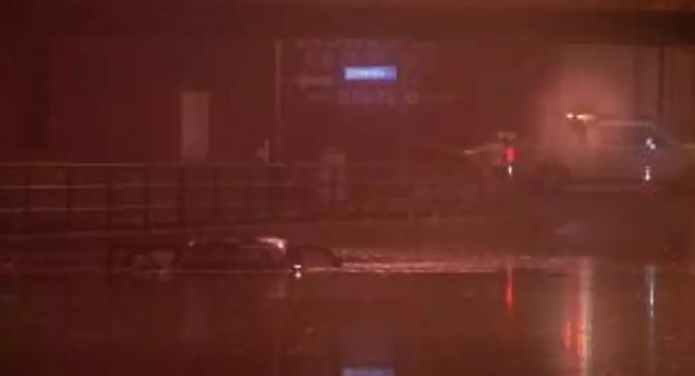
Vehicles were trapped on Niagara St. near Tonawanda St. in Buffalo overnight.
News 4 (WIVB) reported storms came through, bringing in heavy rain that led to flooding in area streets and low-lying areas.
The video above shows the scene on Niagara under the train tracks. At least two vehicles were seen stuck in the middle of the roadway.
It’s not clear how much damage was done, or if anyone was hurt.
News 4 meteorologists say...The second batch of showers and thunderstorms will arrive from the west mainly impacting areas south and west of the Buffalo metro. Again, locally heavy downpours are possible, with some hail, heavy rain, and damaging wind gust potential. The threat will likely focus more south of Buffalo until 2pm with some scattered showers lingering across our northern counties. The showers and storms will exit to our east and clouds will break for sunshine late day.
The forecast calls for warmer and more humid conditions through the end of the week...
Today humid, More Showers and Thunderstorms Develop during the morning and diminish for the afternoon, some Strong-Severe thunderstorms are possible, Clouds break for sunshine PM, High: 68-75.
THURSDAY: Mostly Sunny, High: 79.
FRIDAY: Partly Sunny, Stray Shower/Thundershower late in the day, High: 80.
READ MORE: Here are 10 ways to help others who are struggling right now
More From The New 96.1 WTSS